


Vas île

iznogud
User
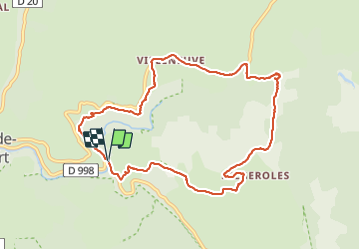

Length
10.2 km

Max alt
1308 m

Uphill gradient
369 m
Km-Effort
15.1 km

Min alt
957 m

Downhill gradient
371 m
Boucle
Yes
Creation date :
2021-08-31 08:25:36.0
Updated on :
2021-08-31 14:34:06.067
5h15
Difficulty : Difficult

FREE GPS app for hiking
 SityTrail
IGN / Geographical institutes
SityTrail Plus
The world is yours!
About
Trail Walking of 10.2 km to be discovered at Occitania, Lozère, Pont de Montvert - Sud Mont Lozère. This trail is proposed by iznogud.
Description
Rando Tarn haut
Positioning
Country:
France
Region :
Occitania
Department/Province :
Lozère
Municipality :
Pont de Montvert - Sud Mont Lozère
Location:
Le Pont-de-Montvert
Start:(Dec)
Start:(UTM)
561101 ; 4912299 (31T) N.
Comments